


Voting District 0025, Wichita County, Texas
About
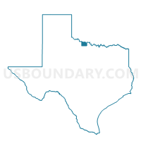
Outline

Summary
| Unique Area Identifier | 678150 |
| Name | Voting District 0025 |
| County | Wichita County |
| State | Texas |
| Area (square miles) | 43.15 |
| Land Area (square miles) | 43.10 |
| Water Area (square miles) | 0.05 |
| % of Land Area | 99.89 |
| % of Water Area | 0.11 |
| Latitude of the Internal Point | 34.11684470 |
| Longtitude of the Internal Point | -98.64032000 |
Maps


Graphs
Select a template below for downloading or customizing gragh for Voting District 0025, Wichita County, Texas


Neighbors
Neighoring Voting District (by Name) Neighboring Voting District on the Map
- Voting District 0023, Wichita County, TX
- Voting District 0024, Wichita County, TX
- Voting District 0049, Wichita County, TX
- Voting District 10, Cotton County, OK
- Voting District 11, Cotton County, OK
- Voting District 7, Tillman County, OK
Top 10 Neighboring County Subdivision (by Population) Neighboring County Subdivision on the Map
- Burkburnett CCD, Wichita County, TX (11,496)
- Electra CCD, Wichita County, TX (4,007)
- East Tillman CCD, Tillman County, OK (1,488)
- Southwest Cotton CCD, Cotton County, OK (1,147)
Top 10 Neighboring Place (by Population) Neighboring Place on the Map
Top 10 Neighboring Unified School District (by Population) Neighboring Unified School District on the Map
- Burkburnett Independent School District, TX (22,258)
- Electra Independent School District, TX (3,174)
- Grandfield Public Schools, OK (1,264)
- Big Pasture Public Schools, OK (1,182)
Top 10 Neighboring State Legislative District Lower Chamber (by Population) Neighboring State Legislative District Lower Chamber on the Map
- State House District 69, TX (140,554)
- State House District 51, OK (37,430)
- State House District 63, OK (36,149)
Top 10 Neighboring State Legislative District Upper Chamber (by Population) Neighboring State Legislative District Upper Chamber on the Map
- State Senate District 30, TX (823,594)
- State Senate District 31, OK (78,520)
- State Senate District 26, OK (69,504)
Top 10 Neighboring 111th Congressional District (by Population) Neighboring 111th Congressional District on the Map
Top 10 Neighboring Census Tract (by Population) Neighboring Census Tract on the Map
- Census Tract 135.01, Wichita County, TX (5,595)
- Census Tract 135.02, Wichita County, TX (4,955)
- Census Tract 138, Wichita County, TX (3,697)
- Census Tract 8712, Cotton County, OK (2,399)
- Census Tract 705, Tillman County, OK (1,487)